







Last year, thousands of samples left five landscapes managed by African Parks in partnership with governments with a promise: we would follow the DNA and report back. The results are now coming in, and they reveal ecosystems in ways we have never been able to see before.
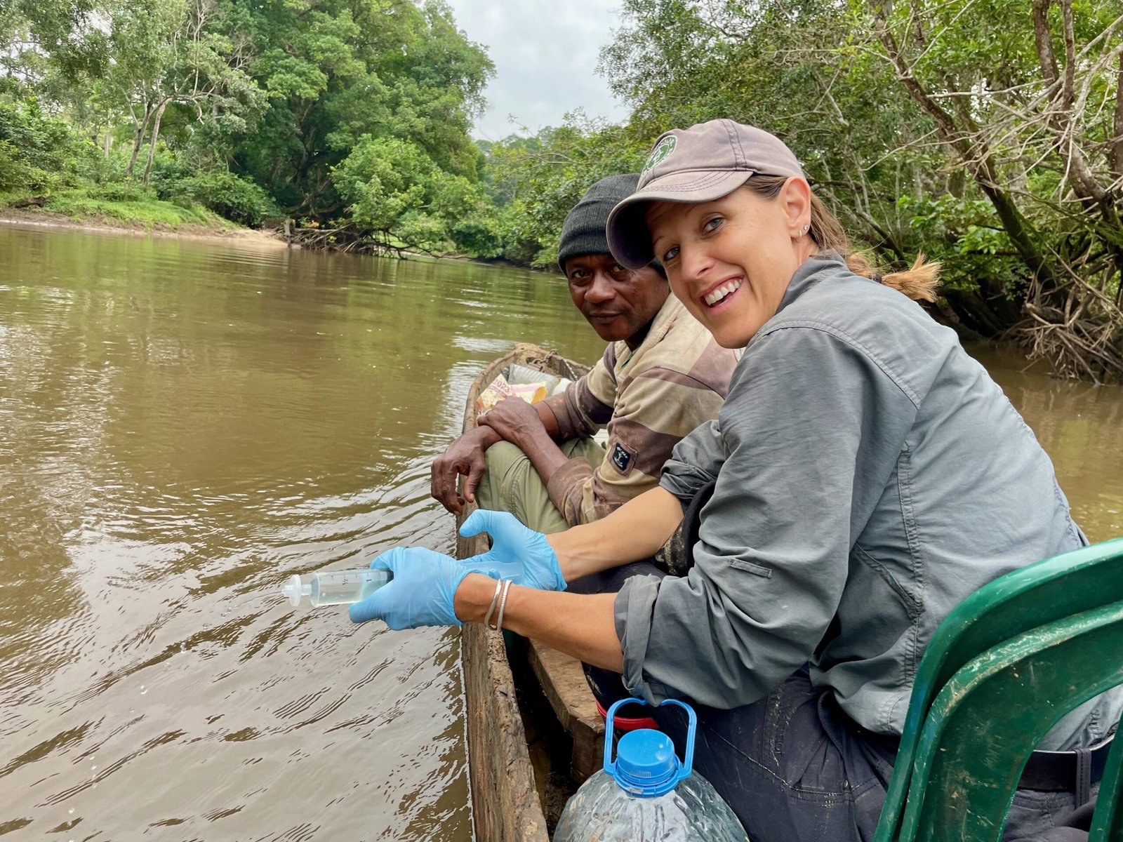
When we last wrote about the Molecular Ecological Network Assessment (MENA) it was still a bold idea being tested. Field teams had crossed desert, savannah, miombo woodland, floodplain and rainforest, non-invasively collecting dung, soil and water. The samples were packed, permitted, guided through customs and shipped to laboratories. Hidden inside them were millions of fragments of DNA. What those fragments would reveal, nobody yet knew.
Those fragments have now come to life: more than 652 million DNA sequences recovered from 4,933 faecal samples, alongside 409 soil samples and 216 filtered water samples. Together, they allow us to describe not only what lives in a protected area, but how the ecosystem is put together: who eats whom, which resources are shared, and whether the whole arrangement depends too heavily on a few species.
The question behind the science
Conservation has always counted wildlife. Aerial surveys count elephants. Camera traps record leopards. Satellites measure habitat. African Parks and its partners rely on all these tools, but they cannot show the full picture. A landscape can contain the expected species and still be losing the relationships that help it function – the feeding links, shared resources and ecological backup pathways that allow a system to absorb disturbance.
MENA was built to reveal this hidden architecture, and the ecosystem-wide properties that emerge from the way its species interact. DNA recovered from faeces tells us which species were detected and, in dung, what animals had been eating. From those dietary clues, we can reconstruct food webs. Each park was sampled alongside a neighbouring unmanaged area using the same protocol and season, giving every landscape its own real-world comparison rather than measuring it against a distant park or an abstract ideal.
The first breakthrough was simply proving that it could be done: one coordinated approach across five countries and landscapes ranging from desert to rainforest yielding thousands of permitted samples collected non-invasively and getting to relevant labs and sequenced timeously. For African Parks, this was a new scale of molecular monitoring that had never been attempted across a protected-area portfolio at this scale.
What the DNA revealed
Across 55,272 square kilometres, the pilot documented 517 vertebrate species, 4,192 plant taxa and 6,601 feeding relationships within the reconstructed park networks. It recorded 29 threatened species and also added animals missing from existing inventories, including 14 new park records at Odzala-Kokoua National Park in Congo. Even in Rwanda’s Akagera National Park, one of the most intensively surveyed parks in the pilot, the DNA added five vertebrates that had not previously been recorded.
But the most important result is not the length of the species list. It is what the connections between those species tell us.
Across a combined measure of community diversity, ecological roles and resource use, all five parks showed an overall healthier signal than their neighbouring unmanaged areas. Inside most parks, plant resources were more diverse and more evenly used, ecological roles were broader, and different herbivores relied on different combinations of plants rather than competing for the same food. Odzala-Kokoua told a different but equally important story: the contrast was smaller because the neighbouring forest remained largely intact, supporting multiple interconnected trophic levels, from elephant and gorilla to a well-developed predator guild.
When an unexpected result becomes the discovery
One of the most striking results began with something we could not do.
We planned to reconstruct a food web for unmanaged areas alongside each of the national parks. In three of the five, the wildlife densities were too low to build a comparable web. Livestock accounted for 62 to 92 per cent of the herbivore samples from these areas, leaving as few as seven wild-animal dietary samples across one of these entire landscapes.
That does not prove that wildlife was absent. But the inability to recover a comparable wild food web, using the same method that produced rich networks inside the parks, is itself an important warning signal.
In Chad’s Zakouma National Park, the contrast became even clearer. Roughly one faecal sample in eight from inside the park was assigned to a carnivore. In the neighbouring Bahr Salamat reserve, the figure was one in 206. The carnivore signal had almost disappeared from outside the park, even though the broader wildlife community still appeared present.
This is exactly why MENA keeps different kinds of evidence separate. One combined score could have averaged a broad community signal against a severely reduced predator signal – and hidden the most important part of the story.
Five parks, five different stories
Kafue National Park, Zambia showed the widest separation from its unmanaged neighbour – the clearest signal in the whole survey of a protected landscape working differently from the land beyond its boundary. Its 21 antelope species divided the available plants between them with remarkable precision, each drawing on a slightly different mix of grasses and browse. That fine-grained sharing of resources is exactly what lets so many grazers and browsers live side by side, and it points to an intact, well-functioning herbivore community.
Akagera National Park showed what molecular monitoring can add even where wildlife is already closely watched. Its herbivore diets were organised along two dimensions at once: browsing versus grazing, and wetland versus upland use. That shows managers how a restored community is functioning as an ecological assemblage, beyond simply counting the animals present.
The pilot’s proving ground in Zakouma National Park revealed the sharp reduction in the neighbouring carnivore signal. It also delivered the project’s strongest lion-genotyping result, identifying 26 individual lion from 44 scats and opening a pathway towards non-invasive population monitoring, thanks to our partners at Stanford University Programme for Conservation Genomics.
Angola’s Iona National Park tested the approach in an arid landscape, where location shaped diet more strongly than species identity. Although livestock occur within the park, competition with wildlife for forage was surprisingly limited across most of the park and concentrated in three localised areas, turning a broad concern into a targeted management question. Within Iona the apex predator had no functional backup for brown hyaena, and the rivers and water points within the park supported around three times the aquatic vertebrate diversity than that detected outside the park.
Odzala-Kokoua National Park produced the richest dataset and most structurally robust park food web, yet the smallest overall difference from its unmanaged neighbour. But its boundary revealed a sharper story: banana and plantain occurred in 22.7 per cent of forest-elephant samples outside the park and none inside, with goats and elephants showing the study’s highest livestock-wildlife diet overlap. MENA revealed that broad ecological similarity can coexist with highly localised pressures.
The people behind the samples
More than 160 people were trained across the five landscapes.
When the University of Rwanda and Akagera ran a joint workshop, 300 students applied for 12 places, half of which went to women. Several participants have since progressed into advanced research and postgraduate opportunities. In Odzala-Kokoua, the training spread through the park itself: Congolese biologists trained field teams, who then trained community members, without an external trainer in the room.
That network of people may prove even more enduring than the first dataset – because they can help generate, interpret and lead the collection of the next sample set.
A new way of seeing ecosystems
This first assessment is a beginning, not a final verdict. It provides a shared molecular view of five very different African landscapes and shows how each park compares with nearby unmanaged land. These are real-world ecological comparisons, not experiments. They do not prove that management caused every difference, but they reveal where wildlife communities, ecological roles and food-web structure diverge – and where closer attention may be needed.
That is the value of a baseline: it gives each landscape a place from which to learn. By returning over time and applying the same approach, African Parks can begin to see which parts of an ecosystem remain stable, which relationships are shifting and where new pressures may be emerging.
MENA is designed to complement the tools that parks already depend on. Aerial surveys show how many large animals are present. Camera traps reveal elusive species. Field teams bring irreplaceable knowledge of place. Molecular evidence adds another layer, exposing diets, shared resources, hidden species, the connections that hold ecological communities together, and how they function.
Around the world, conservation is moving beyond reporting how much land is protected towards understanding what is happening within it. MENA gives African Parks a new way to meet that challenge – not simply by replacing aerial surveys, camera traps or field ecology, but by revealing relationships those tools cannot see on their own.
One year ago, we wrote that all things are connected. We can now begin to show those connections in millions of fragments of DNA. MENA turns those fragments into a living picture of ecological relationships, one that can deepen with every landscape explored and every return to the field. What began with a simple idea is becoming a new way to see the web of life, one strand at a time.
The MENA pilot was made possible through the support of Allen Family Philanthropies. It was delivered by African Parks with partners including Dr. Mathias Pires, CIBIO–University of Porto, iDiv & the Helmholtz Centre for Environmental Research, Stanford University, the University of Rwanda, the University of Zambia, Copperbelt University, and Jonah Ventures Labs.